

Nepal’s Geography and the Influence of the Himalayas

The geography of Nepal is shaped by dramatic elevation change, mountain systems, river valleys, hills, and lowland plains, all of which influence how people live, travel, farm, trade, and build communities. The geography of Nepal gives students a powerful real-world case study in how landscapes shape culture, livelihoods, settlement, mobility, risk, and resilience.
The Himalayas are central to this story, but for teachers planning Nepal school trips, the country offers a clear way for students to connect physical geography with human geography, environmental systems, culture, livelihoods, and community life. Through field observation, guided discussion, and reflection, students can see how terrain, climate, access, and natural hazards influence daily decisions in ways that are difficult to understand from maps alone.
Key Notes
- Nepal’s geography includes the Himalayas, central hills and valleys, and the Terai lowlands.
- The Himalayas shape settlement, travel, farming, climate, livelihoods, tourism, and cultural identity.
- Mountain geography creates both opportunities and challenges, including abundant water resources, rich biodiversity, geographic isolation, landslides, and limited access to infrastructure.
- Nepal is an excellent learning destination for geography, environmental studies, culture, service learning, global issues, and outdoor education.
- A meaningful Nepal student trip should connect landscape study with guided observation, respectful cultural learning, safety planning, and structured reflection.
Nepal’s Physical Geography
Nepal’s physical geography is defined by sharp changes in elevation over a relatively short distance. Students should understand Nepal as more than a mountain destination. It includes high Himalayas, the middle hills, valleys, rivers, and lowland plains, each shaping how people move, settle, farm, trade, and respond to environmental risk.
The Main Geographic Regions of Nepal
Nepal is often understood through three broad regions: the Himalayan region in the north, the central hills and valleys, and the Terai lowlands in the south. A clear overview of Nepal’s geography helps students see how these areas differ in elevation, climate, settlement, agriculture, biodiversity, and accessibility.

Students exploring how Nepal’s mountain landscapes shape movement, settlement, and daily life.
Rivers, Valleys, and Elevation Change
Rivers and valleys shape movement through difficult terrain. They influence where roads can be built, where farms and settlements develop, and how regions connect. Elevation change affects climate, travel time, road access, trade, and daily routines. A strong student inquiry question is: “How does elevation shape the choices people make about where and how to live?”
Climate, Biodiversity, and Natural Hazards
Nepal’s climate varies by altitude, with monsoon patterns and seasonal conditions affecting travel, farming, and field observation. Students can also study biodiversity across mountains, forests, valleys, and lowlands, alongside landslides, earthquakes, flooding, and other natural hazards.

Nepal’s valleys and terraced landscapes help students connect physical geography with farming, settlement, and access.
The Himalayas and Their Global Significance
The Himalayas are part of a wider mountain system with environmental, cultural, economic, and global significance. For students, this makes Nepal a valuable place to connect local field observation with larger global systems.
Why the Himalayas Matter Beyond Nepal
The Himalayas are one of the world’s major mountain systems. They influence climate, water systems, biodiversity, and human settlement across a wide region. In Nepal, students can study how mountain landscapes affect where people live, how communities connect, and how environmental conditions shape daily life.
Mountains, Water, and Environmental Systems
Mountain landscapes connect directly to river systems, farming, drinking water, energy, and downstream communities. Snowmelt and rivers influence water access, while steep valleys and terraced landscapes shape farming and settlement. Students can also explore hydropower potential, environmental change, and pressure on shared resources. A practical activity is for students to create a simple systems map showing how mountains, rivers, farms, settlements, and downstream communities are connected.
Tourism, Trekking, and Responsible Travel
The Himalayas attract trekkers, climbers, and visitors, but student travel should focus on learning, safety, respect, and environmental responsibility. Tourism can support livelihoods, but it can also place pressure on trails, villages, waste systems, and fragile environments. Planning safe school trips abroad means using local guidance, setting realistic activity plans, and helping students understand their responsibilities as visitors.

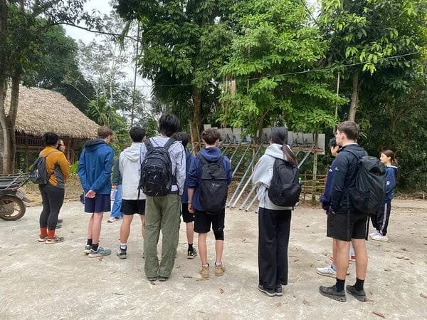
Field observation helps students compare classroom geography with real terrain in Nepal.
Communities and Culture
Geography shapes community life in Nepal, but it does not define every person or place in the same way. Students should avoid broad generalizations and instead study how mountain landscapes, valleys, trade routes, rural life, migration, and cultural diversity interact in specific local contexts.
How Geography Shapes Daily Life
Terrain influences settlement patterns, access to schools, markets, healthcare, and transport. In some areas, steep slopes, distance, and seasonal conditions affect daily routines, travel time, farming, herding, trade, migration, and tourism. These realities can also show students how communities build resilience through local knowledge, cooperation, and adaptation.

Community learning helps students understand how geography, culture, and daily life connect in Nepal.
Cultural Diversity Across Landscapes
Nepal’s varied geography has contributed to strong regional identities, diverse languages, religious traditions, livelihoods, and community practices. Learning about Nepalese cultural diversity and community life can help students understand how Hindu, Buddhist, and local traditions may connect with migration, trade, religion, geography, and identity. Cultural learning should be grounded in context, conversation, and guided reflection, not surface-level observation.
Learning Through Community Interaction
Students can learn through guided community interaction, service learning, storytelling, field observation, and reflection. A strong service learning school trip to Nepal should be built around equal partnership, preparation, humility, and clear learning goals.
What Students Learn From Experiencing Nepal’s Landscape
Nepal helps students move from geography explanation to educational value. It shows that geography is something lived, not only studied on a map. Through place-based learning, students can see how landforms, access, weather, resources, and community life shape real decisions.
Guided reflection helps students connect Nepal’s landscapes, communities, and environmental systems to wider learning goals.
Geography Becomes Real Through Field Observation
Students can observe elevation, slope, rivers, terraces, settlement patterns, trail systems, weather, and land use as they move through different landscapes. Field observation helps them connect classroom geography with real terrain, while comparing maps with what they see on the ground.
- Field observation: Students record changes in terrain, vegetation, buildings, roads, and land use throughout the journey.
- Mapping task: Students annotate a route map to identify and compare key physical and human geography features.
- Reflection question: What does the landscape help explain about daily life in Nepal?
Students See How People Adapt to Place
Students can study farming on slopes and terraces, building in mountain environments, travel and transport challenges, and livelihoods connected to tourism, agriculture, trade, and service. The focus should be learning how people adapt with knowledge, skill, and resilience, not romanticizing hardship.
They Build Global Awareness and Responsible Travel Skills
Nepal can help students think about environmental systems, inequality, access, risk, tourism, service learning, and cultural respect. Well-planned school trips abroad encourage students to ask better questions, listen carefully, understand community context, consider the impact of visitors, and reflect on responsibility.
Turning Landscape Study Into Student Outputs
Strong student programs should end with a clear output. This might include a field journal, annotated map, photo essay, comparative geography report, community interview reflection, environmental systems diagram, risk and resilience case study, or group presentation. A custom educational travel experience with Beyond Classrooms can align these outputs with each school’s curriculum and learning goals.